New Bikeway Master Plan for Laurel!
Council is expecting to vote on the City’s new Bikeway Master Plan at its April 27 Council Meeting – A very exciting step forward to enhance routes around town for residents on two wheels. 🚵
Having a good bicycle infrastructure for our town limits traffic congestion, promotes healthy living, and makes everyday travel safer and more accessible for residents of all ages – whether going to work, seeing a movie, or just out for a ride around our lake or along the river.
It also enhances our town’s attractiveness to residents and businesses by creating a place that’s more vibrant, connected, and natural – all things that make Laurel a good place to live, work, and play. 🙂
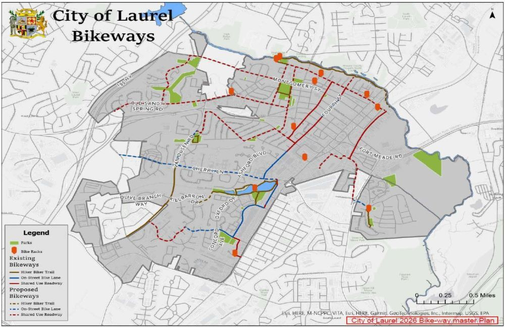
The plan was first created in 2009 and last revised 2016, and the updates identify a few new north-south and east-west routes for people to get around town. The map below shows the existing routes in solid lines, and the proposed new routes in dashed lines.
A related note for those interested: When talking about bike travel, it’s important to distinguish different types of ‘lanes’ (and also important as car drivers to know):
-
Hiker/ biker path – This is a separate path that is distinct from, but often runs parallel to, a road. An example is what you see on Van Dusen Road near the hospital.
-
Striped bike lane – This is a lane on the road but exclusively for bikes. An example is what you see on part of Fourth Street as you move from 198 towards Main. Separate bike lanes can also be ‘protected’, meaning dividers such as polls or walls. For example, this month Council is also voting on design plans for a protected bike lane on Cherry Lane.
-
Shared bike/ parking lane – This is where a road may have a wide shoulder/ parking area that can also easily be used for bicycles to move through. You’re generally not going to see it where lots of cars park, but where parked cars are few and far between (like along Brooklyn Bridge Road).
-
Shared lane – In this scenario, bikes and cars share the same lane. And on designated roads, you’ll see the cycling icons painted onto the road’s surface. Cyclists should generally keep to the right of the lane to allow safe passing, but can move to the center of the lane when needed for safety and where they should not be passed.
Checkout the proposed Bikeway Master Plan here for more information – And if you’re interested to link up with other passionate residents helping create an easily livable, walkable, cyclable, and fun ways to get around town, please consider joining the Bicycle & Pedestrian Advisory Committee (just let me know if interested!).